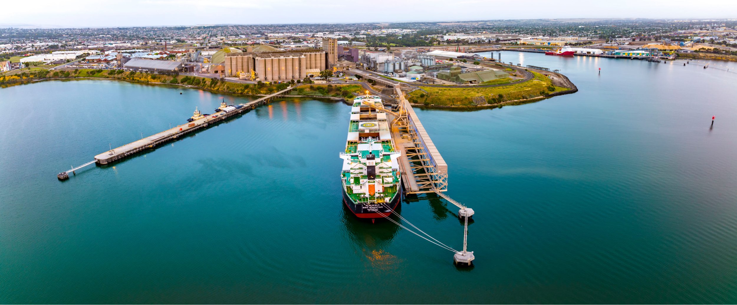
Commercial Drone Services
Architectural
Drone-based aerial surveys, can quickly and easily obtain high-resolution aerial imagery and topographic maps of a site. This can help them make informed decisions about design, placement, and construction of a building.
Aerial Site Surveying
Our platform provides orthomosiac maps, digital surface models, and 3D models that can be easily exported into CAD or BIM software.
Site Analysis and Inspection
Drones can be used to inspect building sites from multiple angles, providing architects with a complete view of the site, architects can detect changes in topography, monitor progress of construction, and identify potential safety hazards.
Ideal for presenting and analysing what if scenarios.
Collaborative Data Sharing
Our solution provides a platform for architects to collaborate and share data with other stakeholders, such as contractors, engineers, and clients.
This helps to streamline communication, reduce errors, and ensure that everyone is working from the same information.
A very economical way of evaluating prospective customer design solutions.

Civil
Our Drones equipped with high-resolution cameras can capture aerial imagery of construction sites, providing your civil earth works company with detailed maps and 3D models of the site.
Site surveys
This can help your Company plan and design and manage your construction projects more effectively, as well as monitor progress and identify potential issues early, saving costly errors.
Our cloud-based software can calculate stockpiles and fill areas with volumes estimates of materials, such as soil, gravel, and rock, on construction sites.
Volume calculations
This can help your civil earth works company accurately estimate the amount of material needed for a project, as well as track progress and ensure that resources are being used efficiently.
We generate topographic maps and 3D models of construction sites, allowing your civil earth works company to analyse terrain and identify potential hazards, such as steep slopes or unstable ground.
Terrain analysis
Our Drones equipped with cameras can inspect construction sites for safety issues and monitor ongoing work for compliance with plans and specifications.
Inspection and monitoring
This can help your civil earth works company identify potential issues and ensure that projects are progressing as planned.
Our cloud-based platform allows your civil earth works company to share data with clients, subcontractors, and other stakeholders, making it easy to collaborate and ensure that everyone has access to the same information.
Collaboration

Construction
Our Drone Capture and cloud solution provides a collaborative virtual site (Digital twin), to track planned build, versus as built over time, by providing a virtual as built model our data capture and tools assist project managers monitor progress, identify potential cost over runs, support claim processes and improve project and stakeholder communication.
Digital Twin
The Management challenge of project management, contractor coordination and monitoring, communicating to ensure delivery on time and budget is costing more than it should according to recent Mc Kinsey report.
Cost Management and savings opportunity
McKinsey –Report on Australian Construction Industry – “Slow adoption of new technology means projects are taking 20% longer to complete”
Our professional Drone data, photos and footage of projects can be used in better demonstrating your company’s unique capabilities in tenders
Tendering Presentations
Our service provides technological advantage to your construction company to improve your competitiveness and communications with stakeholders
Close the gap in your competitive ability
Our cloud based Digital Twin (virtual site model) allows you ease of communication with multiple parties as projects progresses and records important data at every stage in an easy to share format. A valuable resource in relationship and change management
Communications Game changer
Barwon Drone ensure efficient data capture and assist the client use the solution to extract relevant data to improve project management and communication. We manage the aerial data capture so all you need to do is use our intuitive cloud-based solution data to better manage your projects.
Ease of Use

Roofing /Solar
Our Drones equipped with cameras can capture high-resolution images and video of a roofing from different angles, allowing your team to inspect the roof for damage, leaks, and other issues without having to physically climb up and down the roof. This can save time and reduce the risks associated with manual inspections. The quick turnaround and quality presentation will delight your clients.
Roof Inspections
Our cloud-based software can generate accurate 3D models and measurements of a roof, including the area, pitch, and volume. This data can help your team estimate the materials and labour needed for a roofing project more accurately and efficiently.
Saving you considerable time and money as well as sppeding up proposa response time.
Roof Measurement
Our cloud-based platform's collaboration tools allow you to easily share maps, data, and reports with team members, suppliers and clients. This can improve communication and coordination between project stakeholders and streamline project management.
Project Management
Our Drones can be used to inspect roofing and other structures that may be dangerous oe difficult to access by traditional means. This can help ensure the safety of your team and reduce the risk of accidents and injuries.
Safety

Our Drones equipped with high-resolution cameras can capture detailed images of assets such as bridges, buildings, chimneys, towers, and infrastructure. These images can be processed and analysed using our cloud-based software to identify potential issues, such as cracks, corrosion, o other forms of damage.
Asset Inspection
Visual inspection
Our cloud-based platform can also create 3D models of assets using photogrammetry. This process involves capturing a series of overlapping images of an asset and stitching them together to create a 3D model.
This can provide a more detailed view of an asset and help identify potential issues that may not be visible in 2D images.
3D modelling
Our cloud-based platform allows your team to store and manage all your inspection data in one place and you can import files for your workflow into your own system. This makes it easy to access and analyse the data and share it with relevant stakeholders.
Data management

Start Making Better Business Decisions
with our Aerial Data
Precision meets innovation. Elevate your projects with our high-res aerial surveys, collaborative data sharing, and advanced 3D modelling. Redefine efficiency, safety, and insight in every phase. Transform the way you build, inspect, and communicate.